
- This webinar has passed.
Understanding Time and Place by Finding, Using, and Creating Historical Overlay Maps (Land)
June 15 @ 10:30 am - 12:00 pm EDT
$25.00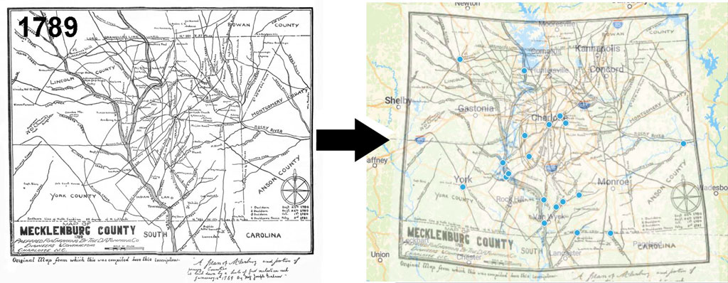
It’s always exciting to find where your ancestors lived. The specific county can often be determined by written documents, but counties can be quite large and their boundaries and even names could change over time. Land records combined with maps can not only help narrow down an ancestor’s specific location, but also provide clues to the lives they lived, the church they attended, where they did business, their access to transportation, and most importantly who else lived nearby. This information is probably not on a modern map, but it could be on an old map. Old maps can also help resolve issues such as no longer used names of creeks, towns, or other landmarks.
We can always compare old and new maps side-by-side, but more accurate results can come from overlaying an old map on top of a modern one. In the past this took skill, time and effort, and some old maps were not very precise making this task almost impossible. Fortunately, there are free tools that let you perform these overlays on your computer. In addition to finding landmarks, you can use modern soil and terrain maps to help get a lay of the land, and maps showing old jurisdiction lines to help determine where to look for records. This lecture will help you find old maps and will demonstrate several software tools for making overlays.